Directions & Contact

The University of Hohenheim is located in the south of Stuttgart - close to the airport and the Stuttgart Trade Fair Center. The university is about 10 km from the city center and can be reached in 30 minutes by public transport.

Arrival by train

Public transportation from the Stuttgart main train station: Stadtbahn U7 or U15 (underground train station) toward Ostfildern to Ruhbank (Fernsehturm), then transfer to the city bus 70 toward Plieningen until the stop Universität Hohenheim.

Alternative: Stadtbahn U5, U6, or U12 (underground train station) toward Leinfelden or Fasanenhof until Möhringen Bahnhof, then transfer to the Stadtbahn U3 toward "Plieningen (Universität Hohenheim)". Then walk to the University of Hohenheim or transfer into the city bus 65 toward Obertürkheim Bf. until the stop "Universität Hohenheim".

Taxi from Stuttgart main train station:
Costs approx. € 20-25. Travel time: approx. 25 min.

Arrival by bicycle

The University of Hohenheim can also be reached easily by bike, especially from the surrounding districts. You can find individual routes in combination with public transportation with VVS’s “Radroutenplaner.”

Arrival by car


There is a fee for using the parking spaces on campus with only a few exceptions. Parking is generally only permitted in designated parking areas.


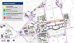
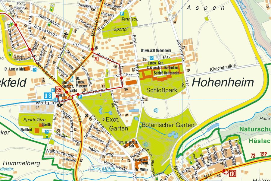
Due to the limited number of parking spaces, we recommend using public transportation or carpools. For carpooling, the University of Hohenheim recommends the “Stuttgart fährt mit” app.

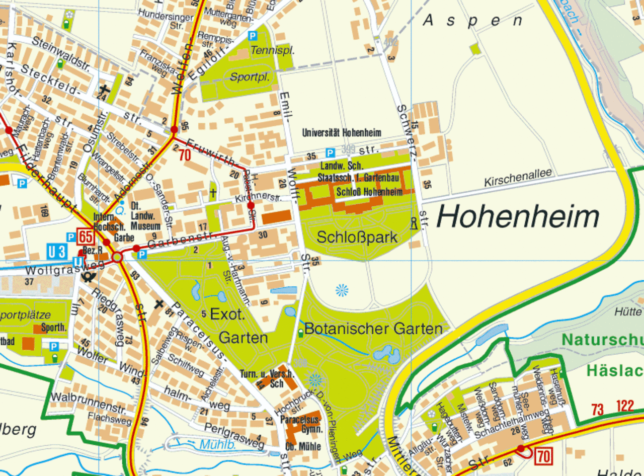
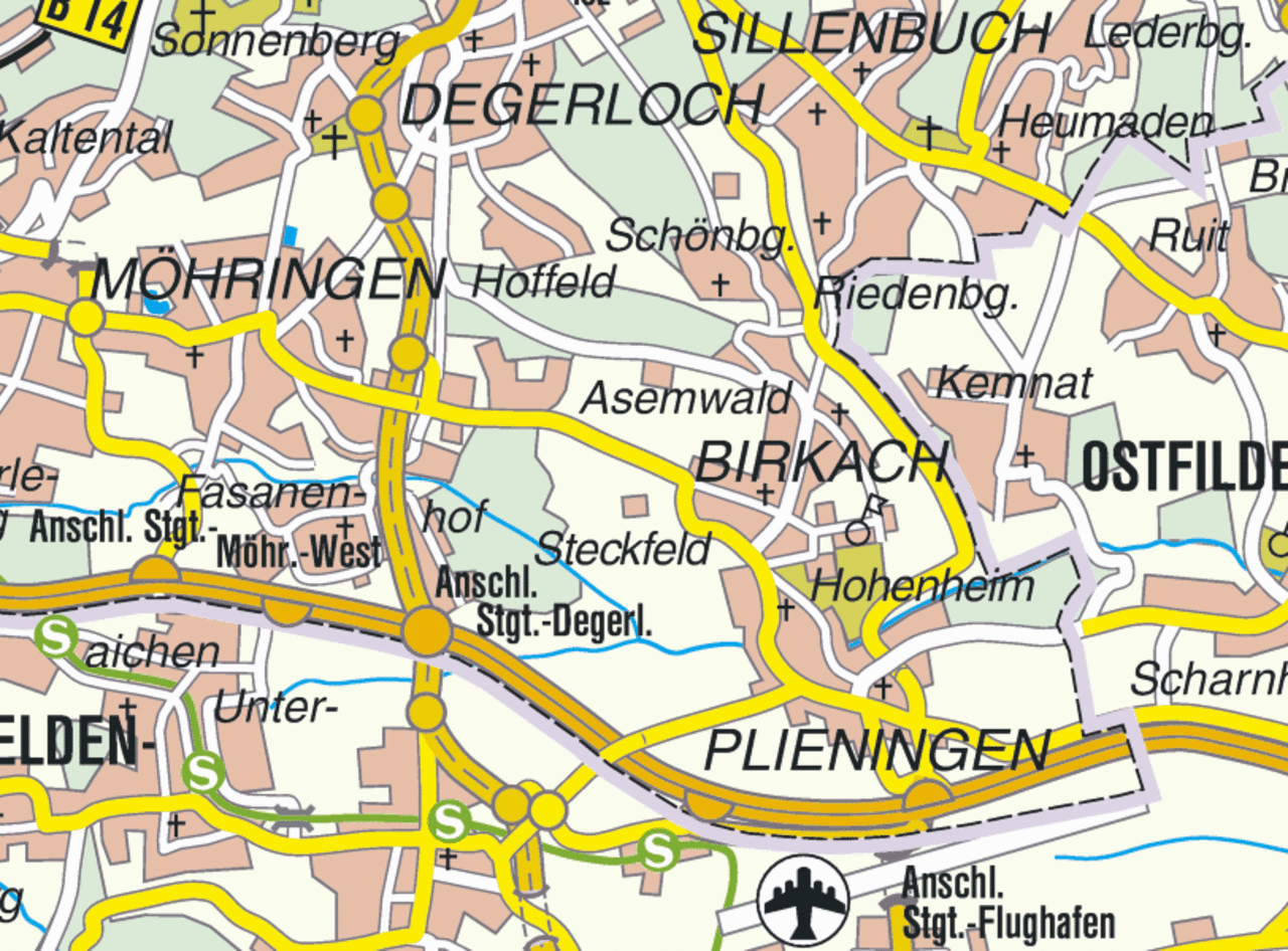
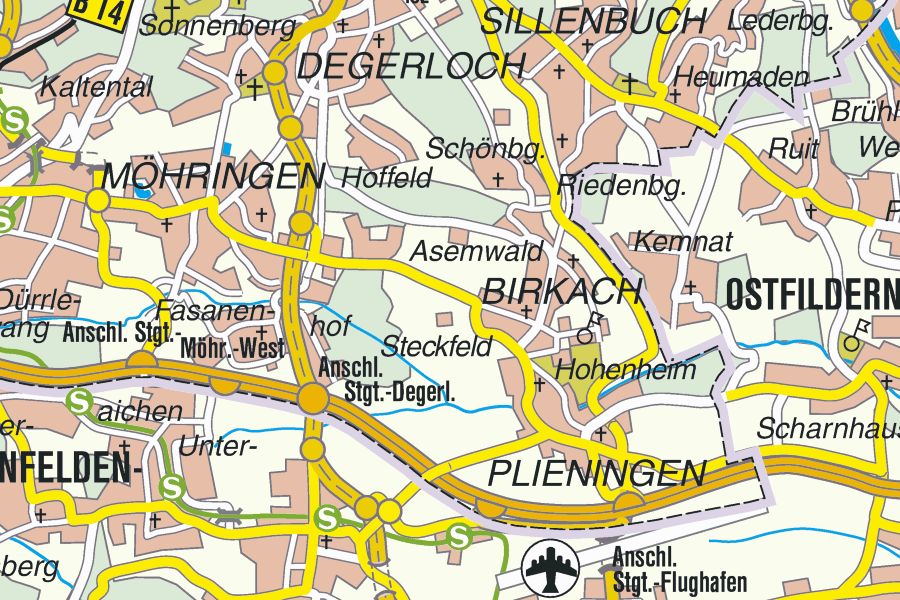
From Stuttgart center: From the B14 (Konrad-Adenauer-Straße), turn onto the B27 (Charlottenstraße) at Charlottenplatz (near the Schloss), then keep driving straight. The street turns into 4 lanes, take exit S-Hohenheim. Follow the signs S-Plieningen/S-Hohenheim for several kilometers until you reach Plieningen. Turn left to the University of Hohenheim. Follow the street and turn right at the next opportunity. Continue to follow the street until you reach the parking spaces.

From Karlsruhe/Heilbronn: Autobahn A8, exit Stuttgart-Flughafen/S-Hohenheim, stay left, and follow the signs for S-Hohenheim. After around 4 km, turn left to the University of Hohenheim. Follow the street until you reach the parking spaces after a sharp left turn.

From Munich: Autobahn A8, exit S-Plieningen/S-Hohenheim, stay right, and follow the signs for S-Hohenheim. After around 4 km, turn left to the University of Hohenheim. Follow the street until you reach the parking spaces after a sharp left turn.

The University of Hohenheim is in an environmental zone. Only cars with a green environmental sticker are allowed to enter, and diesel vehicles only from Euro 5/V.

Arrival by plane

Public transport from Stuttgart Airport:
Take the number 65 bus toward Obertürkheim Bahnhof and get off at the “Universität Hohenheim” stop; journey time approx. 15 mins.

Taxi from Stuttgart Airport:
Cost: around € 15; takes about 15 minutes.

University of Hohenheim mobility concept

For more information about different modes of transportation, current developments, campus connectivity, and contact persons, please visit the mobility homepage.


Campus map for people with reduced mobility


Campus map with WiFi coverage


City map


Regional map

Copyright note

The city and regional maps are from the Stuttgart City Surveying Office. They are to be used on the homepages of University institutions only. In addition, credit must also be given to "© Landeshauptstadt Stuttgart, Stadtmessungsamt 2006”. This copyright mark must be linked to the URL http://www.stuttgart.de/stadtmessungsamt. The direct URL to the city map https://www.stuttgart.de/stadtplan must also be included on the site.